29. Policy Maps & Plans
MAP A Albury Settlement Boundary 33
MAP B Albury Village Affordable Housing Sites 34
MAP C Affordable Housing Sites (Original Nominations from Land Owners) 35
MAP D Rural Enterprise Locations 50
MAP F Showing Cycle Route NCN22 Through the Parish 82
MAP G Designated Neighbourhood Area 96
MAP H Community Facilities Locations 97
MAP I Footpaths Bridleways Byways 98
MAP K Albury Active Travel Map 100
MAP L Albury Bus & Cycle Routes 101
MAP M Albury Footpaths, byways and bridleways 102
MAP O Light Pollution In Albury Parish 104
MAP P SSSI, SNCI, RIGS, Ancient Woodland 105
MAP Q BOAs (Biodiversity Opportunity Areas) 106
MAP R Albury Settlement & Conservation Areas 107
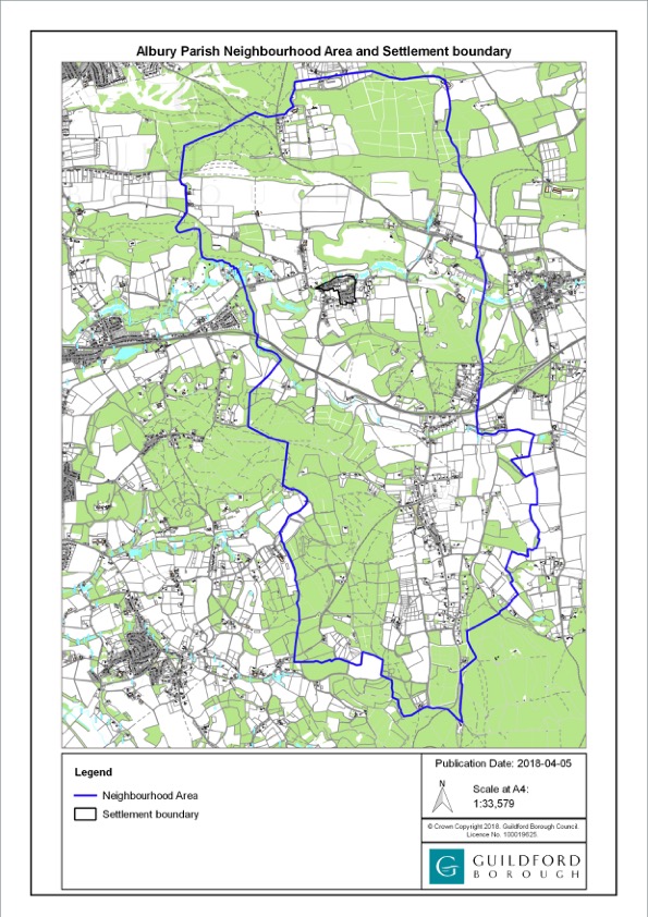
MAP G – Designated Neighbourhood Area
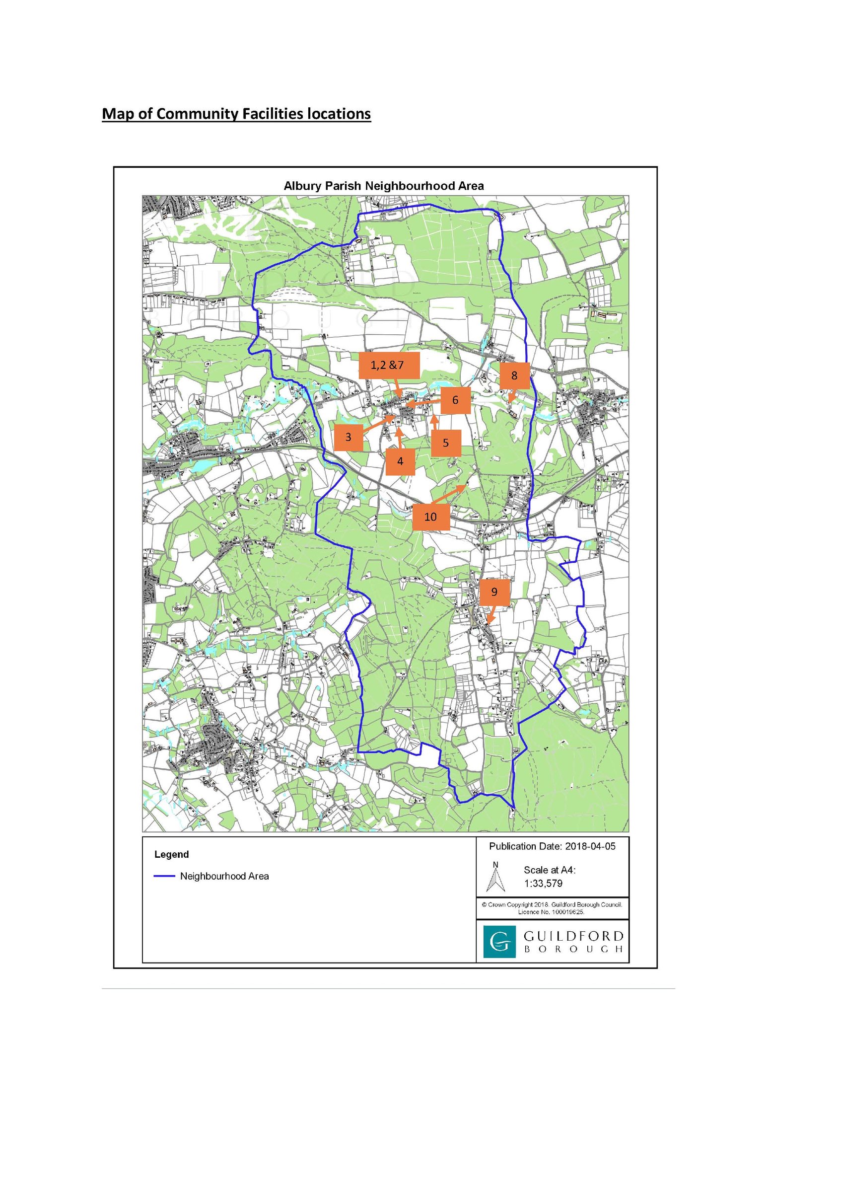
MAP H – Community Facilities Locations
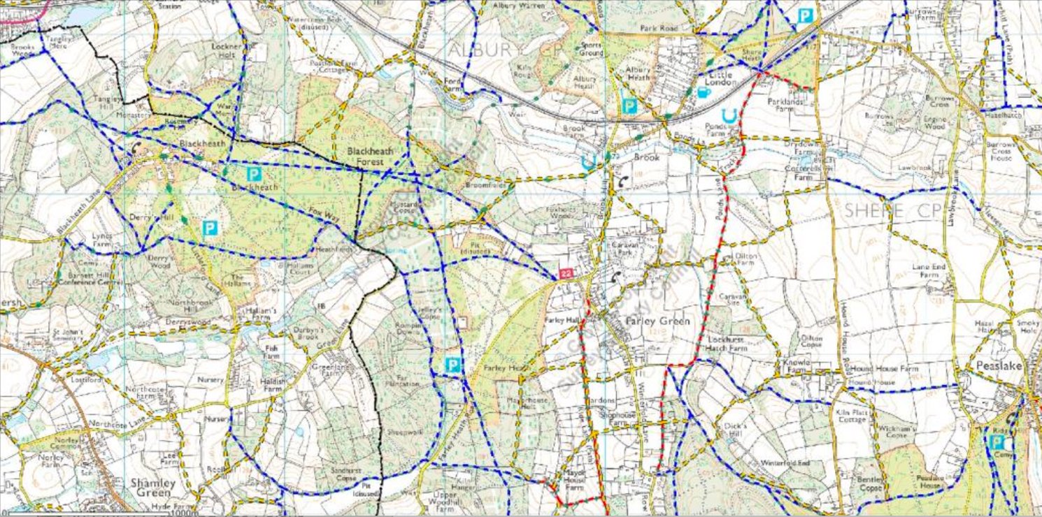
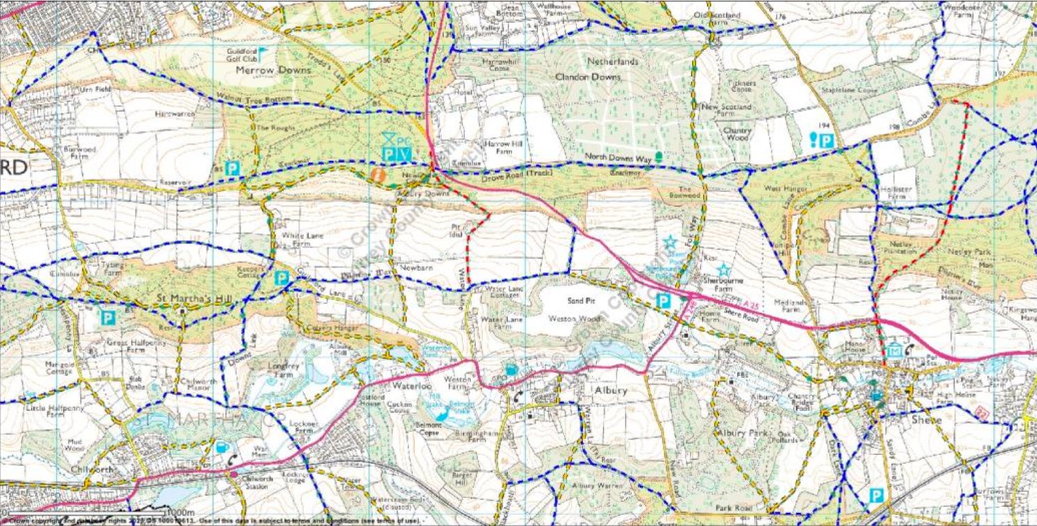
Yellow = Footpaths
Blue = Bridleways
Red = Byways
MAP I – Footpaths Bridleways Byways (Map credit: Ordinance Survey)
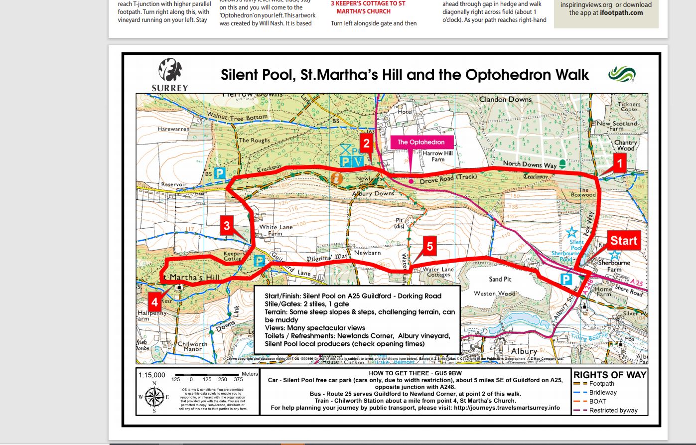
MAP J – Optohedron Walk
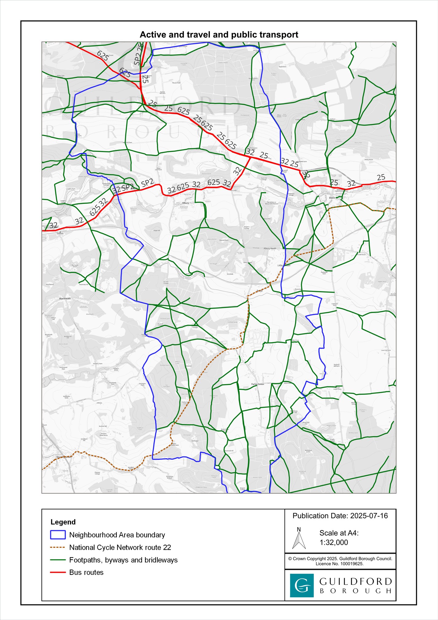
MAP K – Albury Active Travel Map
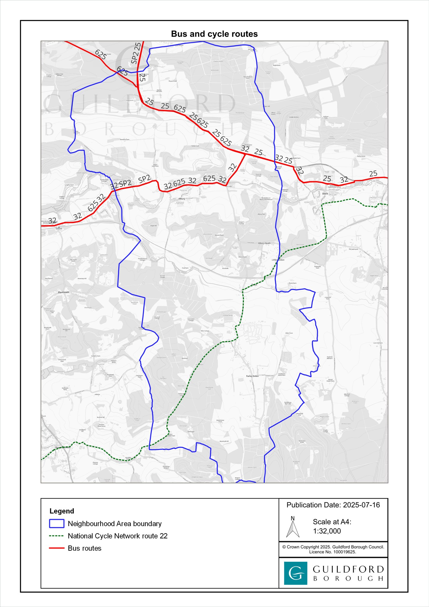
MAP L – Albury Bus & Cycle Routes
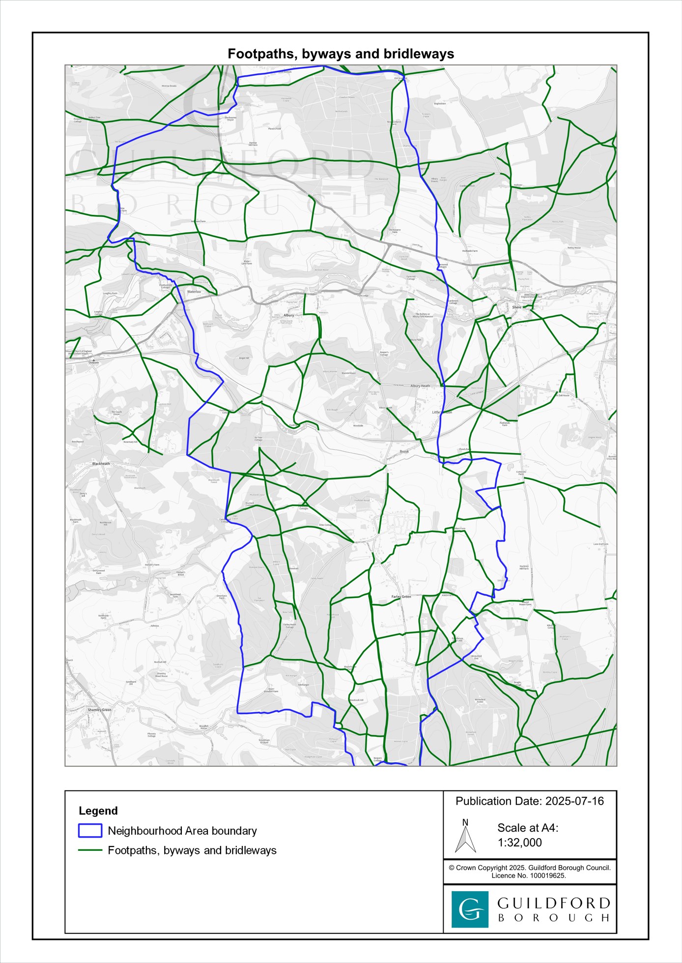
MAP M – Albury Footpaths, byways and bridleways
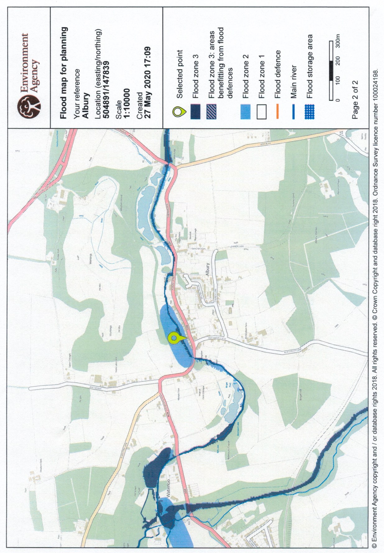
MAP N – Flood Areas
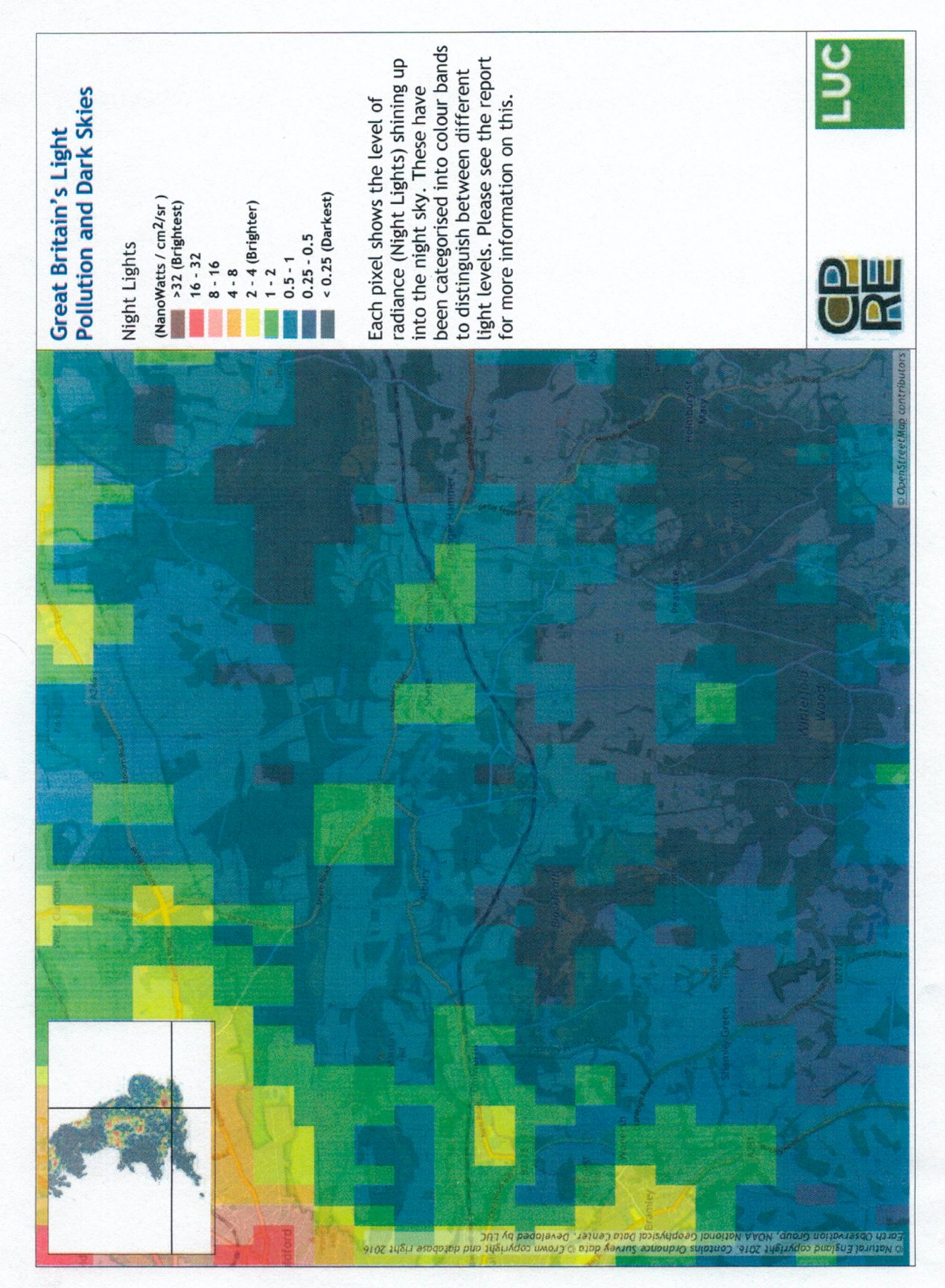
MAP O – Light Pollution In Albury Parish
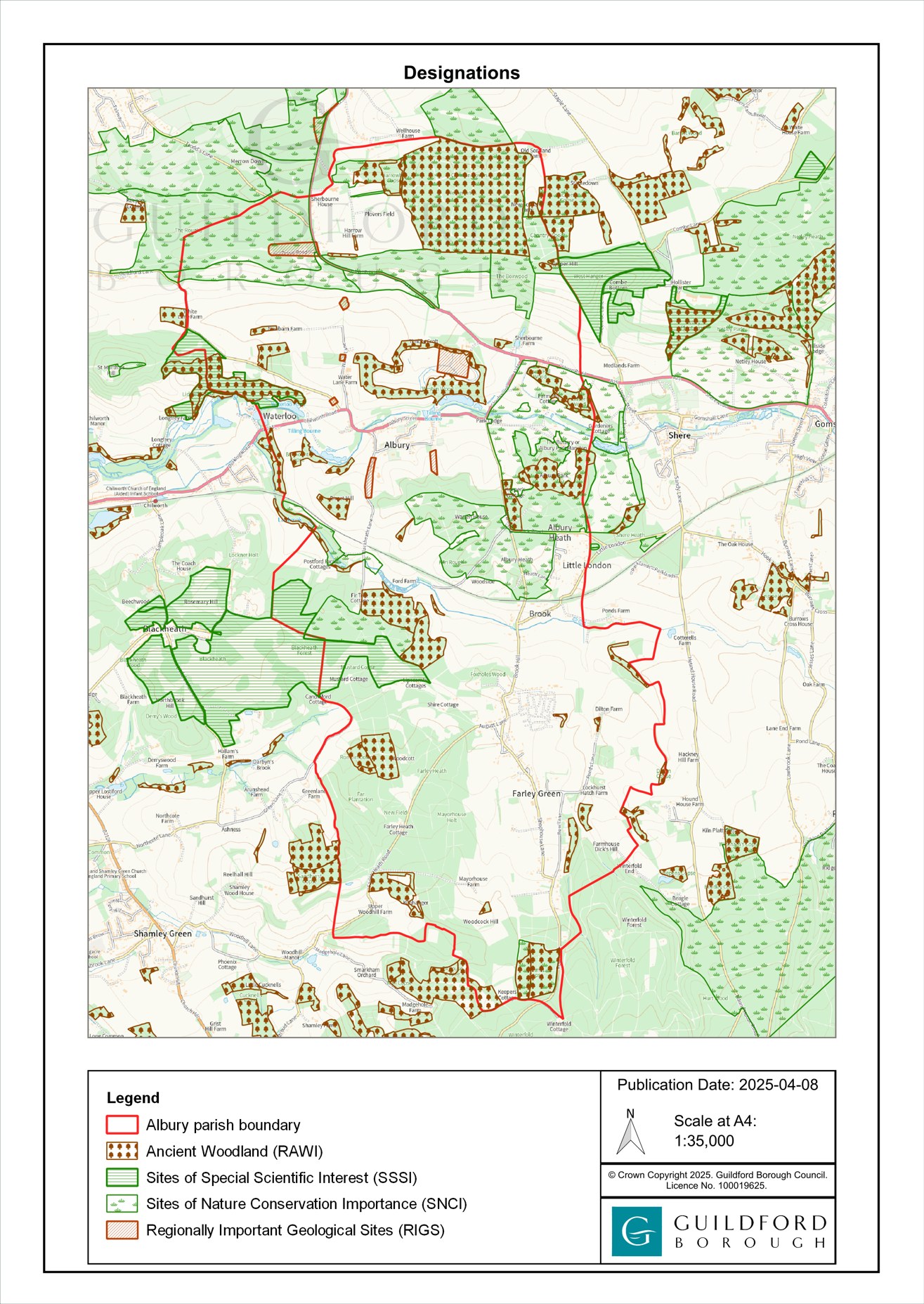
MAP P – SSSI, SNCI, RIGS, Ancient Woodland
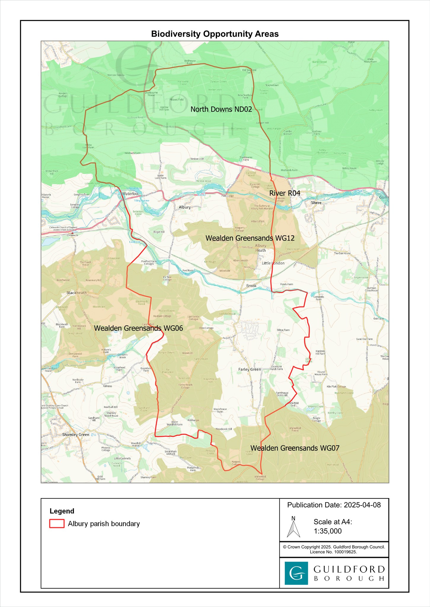
MAP Q – BOAs (Biodiversity Opportunity Areas)
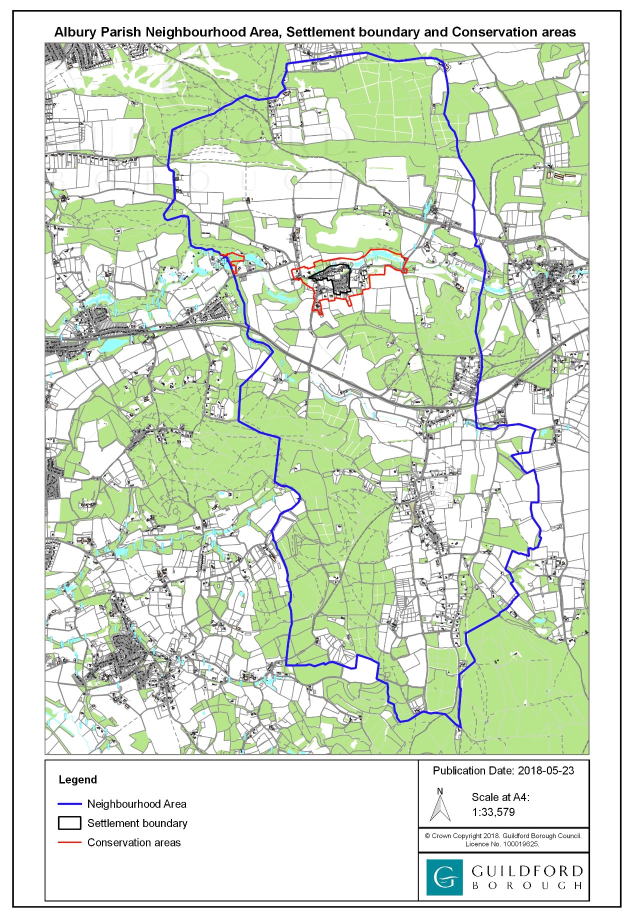
MAP R – Albury Settlement & Conservation Areas