2. The Neighbourhood Area
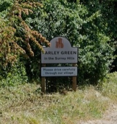
The parish has Albury village at its centre, with separate hamlets at Newlands Corner (2 miles) north of the village and to its south Albury Heath, Little London, Brook (1.5 miles), and Farley Green (2 miles) with extensive open space between them. There are pockets of light rural economy, notably Silent Pool (1.2 miles from Albury village). The parish includes an unusually high number of rights of way-footpaths, bridleways and byways. The inhabited areas are separate but connected, each retaining its unique built style.
The area is largely a rural economy with larger shopping facilities at Guildford and Dorking. Bus services run through the parish to Guildford, Cranleigh and Dorking though there are no railway stations. The nearest train stations are at Gomshall, and Chilworth (Great Western Railway) connecting Gatwick Airport to Reading, and Clandon and Guildford stations (South Western Railway) connecting Guildford to London Waterloo. The A3 and M25 motorways connecting London and further afield, are 5 miles to the north. A substantial upgrade to the A3/M25 Wisley interchange is due to be complete in spring 2026.
There are 456 residential homes in the parish, split geographically as follows:
| Area of Parish | Number of Homes |
|---|---|
| Albury village | 201 |
| Sherbourne | 44 |
| Newlands Corner and North Downs | 11 |
| Farley Green | 127 |
| Albury Heath including Brook and Little London | 73 |
| Total | 456 |
These figures exclude approximately 250 static holiday caravans at Edgeley Caravan Park.
There are 886 names on the Electoral Register (excluding Edgeley Park). With a parish population of 1177 (source 2021 census), split 54% female/47% male. Most residents (74%) own their homes and 26% rent.
56% are employed, of these 31% work part-time1.
The local demographic is more affluent than the national average2:
| Guildford including Albury * | England* | |
|---|---|---|
| AB | 37.97% | 22.96% |
| C1 | 32.39% | 30.92% |
| C2 | 16.4% | 20.64% |
| DE | 13.5% | 25.49% |
The local statistics reflect an aging population in the parish as follows3:
| Age statistics Tillingbourne valley* | |
|---|---|
| Under 16 years | 17% |
| 16-24 years | 8% |
| 25-34 years | 7% |
| 35-49 years | 17% |
| 50-64 years | 26% |
| 65+ | 26% |
2.3Parish boundaries: The parish is bounded to the north by Merrow (3 miles) and West Clandon (4 miles), to the west by Chilworth (2 miles), to the south by Shamley Green (5 miles), Cranleigh (7 miles), and to the east by Shere (2 miles).
2.4Parish history:
Prehistoric Era: Evidence of early human activity includes a large Bronze Age burial mound at Newlands Corner (2400-1500 BC) with Neolithic flint tools found in the surrounding hills. The name “Harrowshill” hints at a possible Anglo-Saxon sacred site.
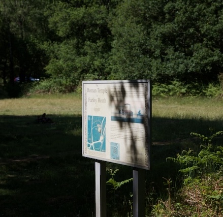
Roman Influence: The remains of a nationally significant Romano-Celtic temple at Farley Heath highlight the area’s importance during Roman occupation. These temples, used for community spiritual needs, are rare in England. A Roman road near Ewhurst likely passed close by.
Ancient Pilgrim’s Way: The Pilgrim’s Way, a route used since the Stone Age and later by pilgrims to Canterbury, crosses the parish. Archaeology dates it back to 600-450 BC. It was a major thoroughfare, becoming part of the North Downs Way in 1978.
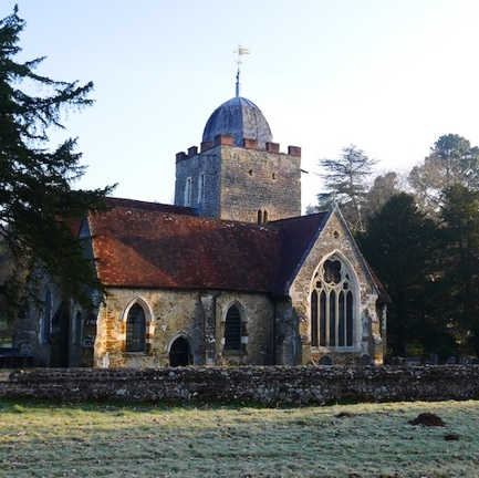
Old Albury Village and Church: The original village was located in Albury Park. Its heart was the Saxon-era St. Peter and St. Paul Church (now the Old Saxon Church), as mentioned in the Domesday Book 1086. The church features Saxon and Norman architecture, including pre-Conquest masonry, a 13th-century door, and a 15th-century painting.
Manorial History: In 1086 Azor held the land and Richard de Tonbridge became overlord after the Norman Conquest, his descendants-maintained overlordship until the 16th century. The Norman Conquest imposed the feudal system-tenant lords paid taxes to the monarch. Roger D’Abernon and his ancestors oversaw the manor for five centuries. In 1633, it was sold to John Gresham of Fulham, who, with George Duncombe, conveyed it to the trustees of Thomas Earl of Arundel in 1638. It then passed to Henry Howard in 1655, who later became Duke of Norfolk. He sold it to Heneage Finch, first Earl of Aylesford. It was subsequently sold to William Clement Finch, and then in 1800 to Samuel Thornton.
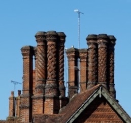
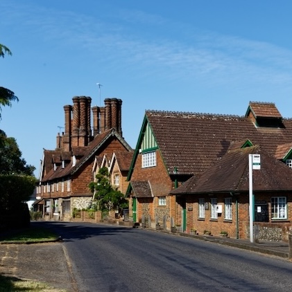
In 1819, Henry Drummond (1786-1860), a prominent MP, religious leader, and banker, purchased Albury Estate, encompassing the entire parish. He commissioned Augustus Welby Pugin (famous for work on the Houses of Parliament) to renovate Albury Mansion and embarked on a building program that significantly shaped the parish. This program included the construction of numerous buildings featuring Pugin’s distinctive “barley twist” chimneys, a hallmark seen throughout Albury village.
Under Henry Drummond, the original village of Albury was relocated to the hamlet of Weston, outside Albury Park. This relocation “enhanced” the privacy and aesthetic of Albury Mansion. The original village buildings were largely removed. Weston was renamed as Albury. Drummond rebuilt Weston House, the former manor house in Weston, constructed the Catholic Apostolic Chapel in Sherbourne, built a mortuary chapel in the Saxon Church and a new parish church St Peter and St Paul (1842) in the newly established Albury village. He established the Catholic Apostolic church which today has 11 million followers worldwide and still brings tourists to the parish. Following Henry Drummond’s death, the estate passed to his daughter who married William Hugh, sixth Duke of Northumberland. Through this marriage, Albury Estate became part of the Percy family’s holdings, one of England’s most influential aristocratic families. They retain ownership to this day, continuing to shape its history and landscape.
Industrial History: Albury Parish, has a rich industrial heritage from the Domesday Book to the late 20th century. The Tillingbourne river’s abundant water resources fueled a range of manufacturing activities. The valley was remarkably industrialized by the 17th century, boasting 24 mills which powered various industries, including corn milling, gunpowder manufacturing, paper making (including bank note production), iron forging, wire drawing, tanning, fulling, and water pumping. The Surrey Vernacular Map 1645-1647 shows a mill at Weston on the Tillingbourne. Albury Park Mill was originally a corn mill built in 1667 but was destroyed by a gunpowder explosion in 1727. Rebuilt in 1790, it became a paper mill under Charles Ball, producing bank notes including counterfeit currency for the French royal family including the Count of Artois, latterly King Charles X of France. The mill ceased operations in 1810 and was converted into a laundry (now the Old Laundry in Albury Park). Early paper mills in the valley produced sheets individually, relying on clean water to process pulp from rags. London, lacking this resource, depended on Surrey’s paper mills. The introduction of chlorine in the late 18th century and improved machinery shifted paper production to London.
In 1809, the Ball family leased two newly built paper mills Postford Upper Mill (Paynes Pond/Waterloo Pond) and Postford Lower Mill (Postford Pond/Bottings Mill in Chilworth parish). These ponds had previously powered the Chilworth Gunpowder Mills in the 17th century. The Grade II listed Pigeon House in Weston Yard, dating back to 1550, is a remnant of the Saxon Manor House of Weston. Weston Yard was the manor’s farmyard. The Pigeon House held over 600 pigeons, used for meat and fertilizer, their droppings used for gunpowder production.
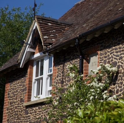
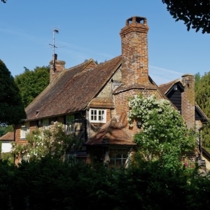
In the 20th century Albury village witnessed significant changes in its housing, primarily through the conversion and demolition of existing structures rather than extensive new construction. In the 1980’s Weston Farm ceased operations, and its former farm buildings were repurposed into residential cottages. Bakery Mews emerged following the closure of the village bakery. Tuppers Court, a former elderly care home, was demolished, and the land redeveloped for social housing now Westonfields. The government’s “right to buy” policy led to the privatisation of council housing at Kingsfield in Farley Green, and Westonfields, shifting the demographics of these neighborhoods. In the 1990’s closure of the milk delivery premises adjacent to the village shop brought new housing development to the site. In the late 20th century Millennium Cottages were constructed on previously disused allotment land, adding to the village’s housing stock. Albury Mill was converted into residential housing, preserving a piece of Albury’s industrial heritage while adapting it for modern living. However, many older buildings remain and the distinctive Pugin chimneys, Bargate stone, and iron stone construction are retained. The 20th century also brought the designation of Conservation area to Albury village, and an area close to St Martha’s. With the advent of the motor car and railway it also brought tourists notably to sites of beauty like Newlands Corner.
Farley Green saw new development in the 1920’s when Albury Estate sold off land to pay death duties. In 1941 the site at Edgeley Park was leased to the Surrey Downs Sun Club, a naturist organisation. The club established chalets, a tennis court, and a swimming pool, marking the site’s early use for leisure. Over time, Edgeley Park transitioned from a basic camping and caravanning site to one featuring circa. 250 permanently sited luxury lodges.
The parish however remains ostensibly rural in nature.
The table below shows the locations in the parish:
| Grade | Description | Location | |||
|---|---|---|---|---|---|
| Albury | Brook | Farley Green | TOTAL | ||
| I | Structure | 2 | 2 | ||
| II | House | 25 | 4 | 2 | 31 |
| II | Structure | 10 | 1 | 11 | |
| Scheduling | Structure | 1 | 1 | 2 | |
| TOTAL | 38 | 5 | 3 | 46 |
All listed properties can be found in APPENDIX E – Heritage report.
2.7Transport: The railway introduced in the late 19th century runs east-west through the centre of the parish south of Albury village but has no stations in the parish. Bus services have reduced in the 20th century and no longer serve areas south of the parish but are confined to the A25 and A248 running between Guildford, and Dorking. The road network consists of the 2 A roads which are known without affection as the “south Guildford bypass”. They are incongruous in the parish traversing The Street in Albury village which has largely narrow or no pavements. Other roads in the parish are rural, often passable by only one vehicle.
2.8Conservation: The parish is in the Surrey Hills National Landscape, the Green Belt, and Area of Great Landscape Value (AGLV). There are Sites of Special Scientific Interest (SSSI’s), areas of Ancient Woodland, and Ancient and Veteran Trees. It also has local designations with Sites of Nature Conservation Importance (SNCI’s), Regionally Important Geological/Geomorphological Sites (RIGS) (MAP P) and a large Biodiversity Opportunity Area (BOA) (MAP Q). There are several endangered species, bats and invertebrates along with ancient trees. These are identified in the Green Infrastructure Report APPENDIX F. These designations distinguish it as an area of high environmental importance, but this also severely restricts development opportunities. The flood map MAP N shows the flood risk from the Tillingbourne River and some areas of the parish suffer from “run off”.
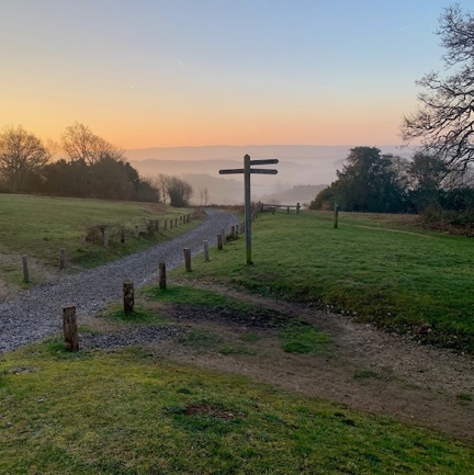
2.9Landscape: The parish is dissected by the river Tillingbourne. The hills on either side were formed over a long period of submergence. Folding and erosion produced the varied landscape. Strips of different rock types run east-west through the area, and these differences give rise to variations in the height of land, its natural vegetation and its present-day land use. Prominent to the north are the North Downs: the chalk rock covered with sand and gravel and woodland. From the summit at Newlands Corner the chalk slopes steeply south. Where the land is too steep to cultivate, scrubland occurs. The lower, gentler, slopes form an open landscape of large fields, under arable cultivation. The chalk is underlain by clay which serves to hold up rainwater draining down through the permeable chalk above. In places this ‘overflows’ creating springs that eroded hollows or ‘combes’ in the hillside producing lakes of water as at The Silent Pool.
The east-west strip is a belt of coarse sand, the Folkestone Beds. Here erosion is slow and the outcrop stands up as a semi-continuous ridge from St Martha’s Hill in the west to Weston Wood in the east. Soils on the Folkestone Beds are very infertile and dry. Consequently, the outcrop is heavily wooded largely with conifers, heather and ferns. The Folkestone Beds lend their character to many buildings in the parish as mixed with the sands are thick layers of ironstone which feature as blocks and layers in house fronts and walls, whilst smaller chips are embedded as decoration in the courses of mortar.
The valley floor is cut down into a layer of sandstones which are equally infertile; the Hythe Beds. They can be seen in the land south of the Tillingbourne, where sunken lanes exposure them and a wider outcrop of Folkestone Beds. Much of this is, wooded but the southern half forms the open scrub of Blackheath, Albury Heath and Farley Heath where the Hythe Beds reappear to form the wooded escarpments of Winterfold Heath, Pitch Hill and Holmbury, overlooking the clay lowlands of the Inner Weald.